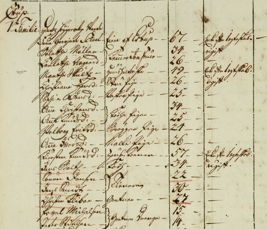
Households and servants
In 2025, the center began developing a nationwide database of servants at all approximately 700 Danish manors in order to secure, make available and disseminate the special cultural heritage hidden in the detailed records of the Danish censuses and to systematically activate and develop this material. Read more about the work here.
As an extra layer to danskeherregaarde.dk, information about the manors' total households and their servants has been added in connection with the project. For each manor description, you can find information about this based on censuses from 1787, 1801, 1834, 1850 and 1860.
In collaboration with Danmarkshistorien.dk at Aarhus University (now part of lex.dk), the research center has prepared a theme on Danish manors. This includes the history of the manors, 14 specific manor histories and a selection of source material.